blowing dust and microbursts in rockford, il
16 june 2024
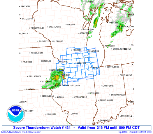
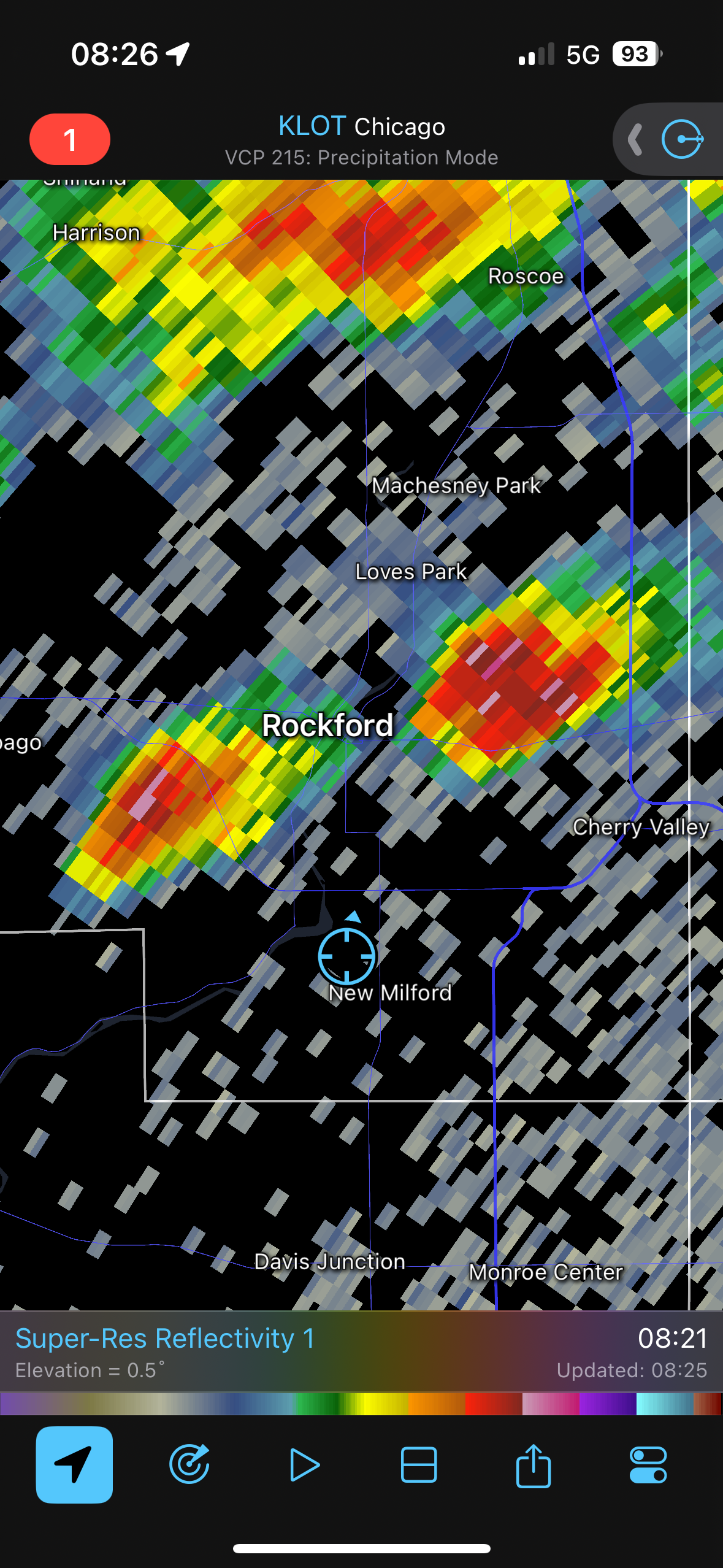
on sunday, 16 june 2024, a mesoscale convective vortex (mcv) tracked northeast across northern illinois, producing scattered wind damage and widespread outflow-driven impacts. according to the national weather service in chicago (nws lot), the mcv originated from a decaying thunderstorm complex and generated gusty winds, blowing dust, and a damaging microburst on the west side of rockford, il.
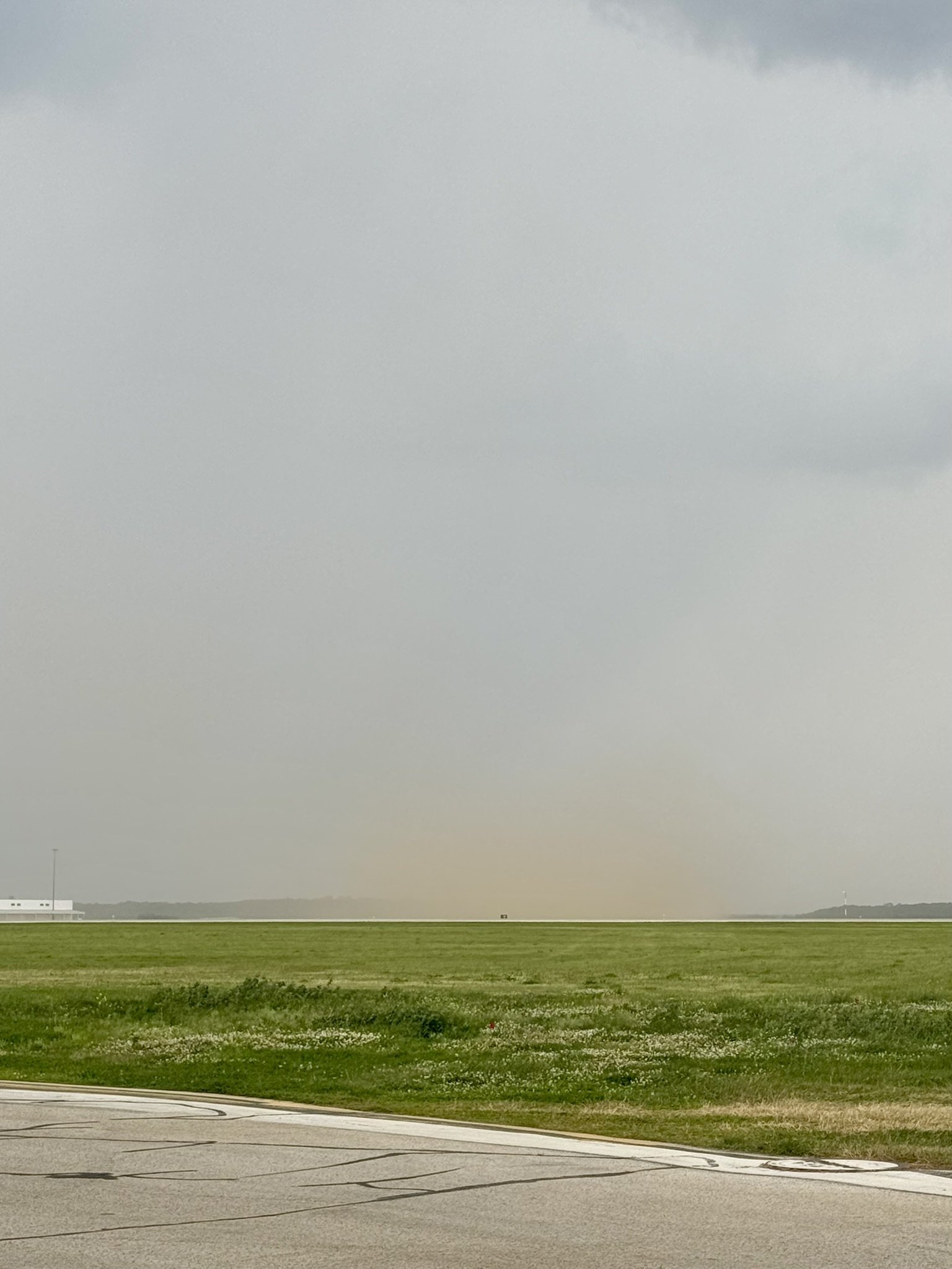
at krfd, i observed notable shifts in wind direction and speed, the development of blowing dust (bldu), and cumulonimbus growth as the outflow boundary and mcv passed overhead. these features appeared in metar/speci updates throughout the shift. the case illustrates how subtle, localized systems can present operationally significant aviation hazards—even without heavy precipitation or lightning.

morning convection preceding the mcv


obs transmitted
SPECI KRFD 161317Z 16011G21KT 10SM TS SCT041CB BKN050 BKN120 BKN250 23/14 A2990 RMK AO2 LTG DSNT N AND NW RAB11E13 TSB11 OCNL LTGIC OHD TS OHD MOV NE P0000 T02330144=
SPECI KRFD 161339Z 17011G17KT 10SM SCT041CB BKN050 BKN120 BKN250 24/16 A2990 RMK AO2 LTG DSNT N AND NE RAB11E13 TSB11E38 CB N-NE MOV NE P0000 T02440156=
METAR KRFD 161354Z 17012G21KT 10SM FEW041 SCT050 BKN180 OVC250 26/16 A2990 RMK AO2 LTG DSNT N AND NE RAB11E13 TSB11E38 SLP118 CB DSNT NE MOV NE P0000 T02560156=
METAR KRFD 161454Z 18013G22KT 10SM FEW045 FEW055 BKN240 28/18 A2988 RMK AO2 RAB1355E1357 SLP113 P0000 60002 T02830178 58005=
METAR KRFD 161554Z 18013KT 10SM FEW060 SCT190 BKN250 31/19 A2987 RMK AO2 SLP108 T03060194=
METAR KRFD 161654Z 20016G23KT 10SM SCT170 BKN250 32/21 A2985 RMK AO2 SLP102 T03220206=
METAR KRFD 161754Z 18018G29KT 10SM FEW050 SCT210 BKN250 33/20 A2984 RMK AO2 PK WND 20029/1747 SLP096 60002 T03280200 10328 20217 58016=
METAR KRFD 161854Z 18014G28KT 10SM SCT048 BKN060 BKN250 33/21 A2983 RMK AO2 PK WND 21028/1847 SLP094 T03330206=
METAR KRFD 161954Z 20014G25KT 10SM SCT055 SCT075 BKN250 33/20 A2982 RMK AO2 PK WND 23027/1920 SLP089 T03330200=
SPECI KRFD 162047Z 20017G27KT 10SM TS SCT055CB SCT070 OVC250 32/20 A2981 RMK AO2 PK WND 20029/1959 LTG DSNT SW AND W TSB41 OCNL LTGICCG SW-W TS SW-W MOV NE T03220200=
METAR KRFD 162054Z 21029G46KT 10SM TS BLDU SCT055CB SCT075 OVC250 31/19 A2983 RMK AO2 PK WND 20046/2052 LTG DSNT SW AND W TSB41 PRESRR SLP095 OCNL LTGICCG SW-W TS SW-W MOV NE T03060189 55002=