distant storms over dubuque, ia
24 september 2023
on the evening of 24 september 2023, a cluster of sub-severe thunderstorms developed over eastern iowa, primarily across dubuque county. although the storms remained well over 150 miles west-northwest of kord (chicago o'hare), they were clearly visible from the ground thanks to favorable viewing conditions.
these storms were elevated in nature, forming above a stable surface layer. with limited surface-based instability and no severe weather warnings issued, the storms likely initiated along a weak mid-level boundary or zone of modest ascent. despite their limited intensity, they reached high enough into the atmosphere to be seen at a considerable distance—especially as the setting sun illuminated their anvils from below.
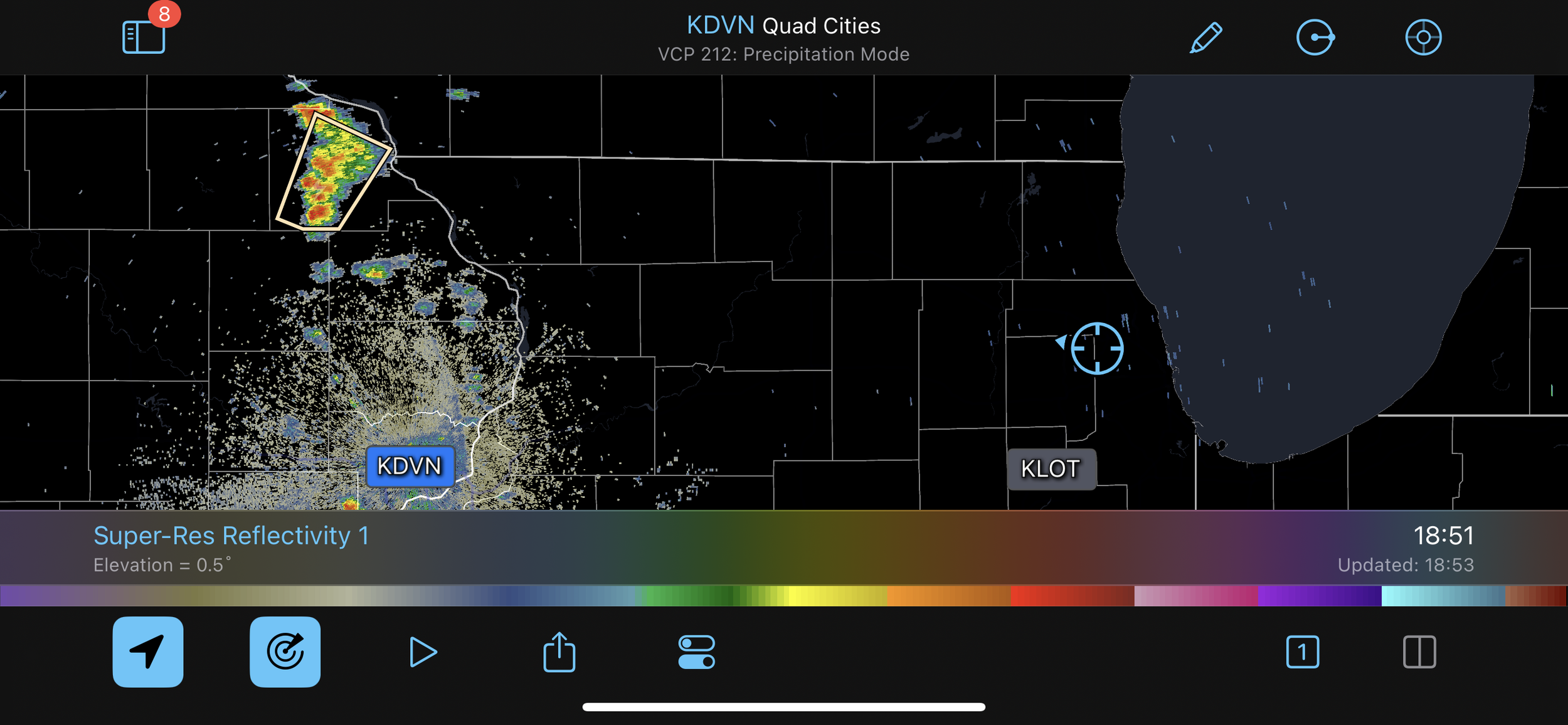
radar data from kdvn (quad cities) at 18:51z showed isolated convection along the mississippi river near the iowa–wisconsin border. the clean, dry air mass over northeastern illinois provided an unobstructed view of the western sky, allowing for clear sightlines toward the distant cloud tops.
this event is a good example of how visibility across the midwest can extend for over 100 miles under the right atmospheric conditions. it also illustrates how elevated convection, even when not severe, can be visually prominent and informative about mid-level atmospheric processes taking place well away from the surface.