sweltering heat and severe thunderstorms in chicago, il
27 august 2024
after a day of extreme heat and humidity in chicago — with heat indices well over 100°f — the atmosphere was primed for convection. surface temps reached the upper 90s with dew points near 80°f. by late afternoon, mlcape had climbed above 4000 j/kg. the setup was classic: rich low-level moisture, strong surface heating, and just enough shear for organization.
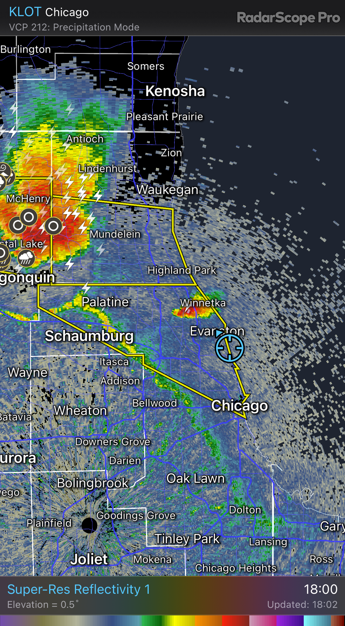
around 6 pm, isolated towers began going up near the north shore. the first image in this set shows one of those “turkey towers” — a narrow, vigorous updraft pushing vertically into the atmosphere. shortly after, radar picked up on this same cell over evanston and winnetka.
as storms matured and merged, a dramatic shelf cloud developed along the leading edge of a larger cluster pushing in from lake and mchenry counties. the structure was textbook — tiered, arcing, and rolling east with a gust front that quickly surged across the lakefront. beachgoers stuck around a bit too long before the outflow hit.
most of the storms produced damaging wind gusts, localized downbursts, and large hail (up to 2.5" in woodstock). while no tornadoes occurred, this was a classic example of high-instability, moderate-shear convection with rapid upscale growth.
the photos capture everything from early-stage development to the organized outflow structure — a full arc of storm evolution right over the city.